Along the Berlin Wall - From urban to rural Berlin
Starting at the Berlin Wall Memorial, the tour leads along the former Bornholmer Strasse border crossing to the rural border area between Blankenfelde and Lübars.
Construction of the Wall was commenced on 13 August, 1961. All streets and crossings were blocked overnight by means of a multi layered barbed wire fence guarded by armed border troops. The Wall divided east and west portions of the city for a little over 28 years. It cut the city in two, ran through buildings, interrupted streets and tore apart families, friends and couples, who did not know if they would ever see each other again. The Wall was finally overcome on 9 November, 1989, triggered by developments in Eastern Europe and East Germany – officially the German Democratic Republic (GDR).The total length of the Wall encircling West Berlin was 155 km. Within the city it’s length totalled 43 kilometres, dividing east and west. A little over a third of this distance ran along the district border of Pankow, a good reason to search for traces here. Pankow (400,000 inhabitants) is on one hand the epitome of urbanity (e.g. Prenzlauer Berg).
On the other hand the district is gradually becoming a rural idyll in the north, filled with na ture and greenery. The route follows a section of the “Berlin Wall Trail” and leads from the centre to the outskirts. The transition to the neighbouring state of Brandenburg is almost imperceptible. The bike tour takes you past exciting sections of historic interest, with traces or remains of the old wall, alternateing with stretches of natural beauty and those that relate to more personal stories. In any case, you can learn a lot about the divided and reunited city of Berlin. The route is recommendable for both visitors and residents alike.
Notes: Most of the time the route runs along cycle paths or quiet side streets. Very few passages lead over cobblestones. The route is very even. There are no slopes. The printed bike tour maps in German and English can be obtained free of charge from the Tourist Information Center in the Kulturbrauerei in the Sudhaus, House 2 (opposite the supermarket), Schönhauser Allee 36, 10435 Berlin.
Berlin Wall Memorial
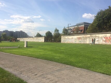
The Berlin Wall Memorial begins in the immediate vicinity of the Nordbahnhof S-Bahn station. It is the central memorial of the German division. The last section of the Berlin Wall, including the border wall, hinterland wall, control strip, patrol road, etc., is more than one kilometre long. Opposite the site there is a visitors’ centre which provides a comprehensive insight into the history of the German division. When construction of the Wall began on 13 August 1961, particularly dramatic events took place on Bernauer Straße. Here the border did not run in the middle of the street, where a wall could be built, but directly at the front of the houses. This meant: the houses themselves were in the east, with the west directly in front of the window. Many people fled to the west by climbing through the windows. Little by little the windows were walled up. Those who wanted to escape had to move to higher floors. They either abseiled down or jumped. Down below, the West Berlin fire brigade positioned themselves with jumping blankets and thus saved many lives. When finally, only windows on the top floors were open, the jumps were often fatal and resulted in first “Wall casualties” to be mourned here.
www.berliner-mauer-gedenkstaette.de
Opening hours:
- Visitor Centre/Documentation Centre: Tuesday to Sunday 10 am- 6 pm,
- Observation tower: Monday 10 am - 4 pm, Tuesday to Sunday 10 am - 6 pm
- Exhibition / memorial site: open daily from 8 am - 10 pm
Adress:
- Bernauer Straße 111, 13355 Berlin
S-Bahn:
- Nordbahnhof (S1, S2, S25, S26)
U-Bahn:
- U Bernauer Straße (U8)
Tram:
- Gedenkstätte Berliner Mauer (M10)
Mauerpark
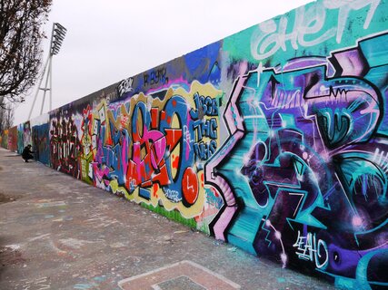
Mauerpark is located between Bernauer Straße and Gleimstraße. The Berlin Wall ran right through it. Previously, there was a railway station on the western side of the area. On the eastern side, there was a parade ground and afterwards a sports facility.The distinctive rampart runs through the grounds in a north-south direction and forms the back of the stadium. It was heaped up from war debris. The former railway station still belonged to the western territory, the slightly ascending terrain towards the stadium belonged to the eastern territory. In 1988, the West Berlin Senate swapped the eastern part of the railway station site for a different area. This agreement shifted the border by about 50 metres to the west. There have been several such exchanges of territory. Eventually, some plots of land officially belonging to West Berlin were scattered like islands in East German territory. They were very difficult to get to. On the slope of Mauerpark, the so-called hinterland wall has been preserved over a length of about 300 metres. Today, graffiti sprayers use it as a practice area for their artwork. The space between the border wall and the hinterland wall were called “death strip”. Whoever wanted to cross this strip risked being shot at by the East German border troops serving in the watchtowers or directly on the border strip. Getting shot at was not only possible but actually happened many times. After the fall of the Wall, the Berliners quickly took back possession of the site and used the space for their leisure activities. In 1992, it was decided to preserve the entire area as a park. Today, Mauerpark is a popular meeting place for visitors from all over the world.
www.mauerpark.info
Adress:
- Eberswalder Straße 1, 10437 Berlin
Tram:
- Friedrich-Ludwig-Jahn-Sportpark (M10), Wolliner Straße (M10)
U-Bahn:
- U Bernauer Straße (U8)
- U Eberswalder Straße (U2)
Gleimtunnel
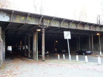
The Gleimtunnel was built in 1911 as an underpass for several railway tracks. It connected the two districts Prenzlauer Berg and Wedding. At the end of World War II, it was the scene of heavy fighting during the conquest of Berlin by the Red Army. With the construction of the Berlin Wall on 13 August 1961, the tunnel became part of the border fortifications and was closed until September 1990. It has hardly been changed since it was built over a hundred years ago. Today it is a listed building, partly because of its castiron columns. One of the few accessible sewers that led to the west ran under Gleimstraße. Before the border system left almost no “loopholes” many East German citzens managed to escape through this canal. The Gleimtunnel was one of the places in Berlin where the divisive brutality of the Wall became particularly evident: At the top of the tunnel, people from the western part of the city gathered in order to at least wave to their friends, neighbours or relatives. Apart from writing letters, this was the only remaining possibility of contact with each other. Two years, after the Berlin Wall went up, the first of several “border pass agreements” provided a regulation which enabled the population of West Berlin - in a limited framework - to visit their relatives in the eastern part of the city. After 1966 there were no further agreements of this kind. It was not until 1972, when visas for day trips restricted to East Berlin were issued without previous application in a simplified procedure at the border crossing (valid from morning to midnight). Permits to cross the border to the West were only granted in rare occasions (hardship cases).
Adress:
- Gleimtunnel, 13355 Berlin
Tram:
- Schönhauser Allee (M1)
S-Bahn:
- Schönhauser Allee (S8, S41, S42, S85)
- Gesundbrunnen (S1, S2, S25, S26, S41, S42)
U-Bahn:
- U Schönhauser Allee (U2)
- U Gesundbrunnen (U8)
Bösebrücke – Grenzübergang Bornholmer Straße (border crossing)
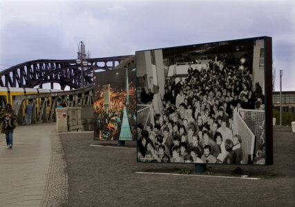
In the collective memory, the Bösebrücke, also known as Bornholmer Brücke, is inseparably linked with the night the Wall fell, on 9 November, 1989. The bridge connects the districts of Wedding and Pankow on Bornholmer Straße. The riveted steel structure was built in 1916 and bears its name in honor of Wilhelm Böse, who was in resistance to National Socialism and was sentenced to death for it. From 1961 to 1990 the border crossing Bornholmer Straße was located on top of the bridge. In the early evening of 9 November 1989, shortly after the famous press conference took place when Günter Schabowski announced the “immediate and prompt” freedom of travel for East German citizens, thousands of them flocked to the border crossing on Bornholmer Straße and demanded to be let through.The border guards, under a considerable amount of pressure, finally opened the barrier at around 10.30 pm. Tens of thousands of people crossed the border that night. The border crossing at Bornholmer Straße was the first where barriers were opened. What was later to be refered to as the “Fall of the Berlin Wall”, occured here first. Numerous television teams broadcast the historic event live from Bornholmer Brücke all over the world: the waiting, the jostling, the fear, and finally the tremendous joy and boundless euphoria of the people crossing the border.
Adress:
- Bösebrücke, 10439 Berlin
Tram:
- Bornholmer Straße (M13, 50)
S-Bahn:
- Gesundbrunnen (S1, S2, S8, S25, S26, S85)
S-Bahnhof Wollankstraße
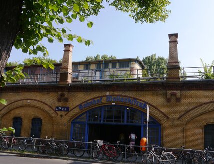
The suburban railway station (S-Bahn) Wollankstraße in Berlin was a special feature among suburban railway stations during the era of the wall. The train station is located in the district of Pankow and thus, belonged to East Berlin. However, it was only accessible from the West Berlin district of Wedding. The eastern entrances of the station were walled up.One of many absurdities of the Berlin Wall era became apparent: a railway station on East Berlin territory, accessible only from West Berlin and served only by West Berlin SBahn lines, which in turn were owned by East Berliners, but were only allowed to be used by West Berliners. Due to post-war allied agreements, the entire S-Bahn system of Berlin with all trains and lines was operated by the Deutsche Reichsbahn until 1984. The latter, in turn, was a state-owned enterprise of the GDR (East Germany). With the income from ticket sales in West Berlin, the GDR was able to earn foreign currency, i.e. “Westmark”. In East Berlin, people paid with “Ostmark”. Shortly after the wall was built, the Governing Mayor of Berlin, Willy Brandt, called for a boycott of the S-Bahn, arguing that people should not support the state which had built the Wall. Slogans such as “Whoever rides the S-Bahn pays for the barbed wire” underpinned this call. Several years later, many West Berliners still refused to use the S-Bahn. In 1962, the urban railway station Wollankstraße made headlines when the station’s platform caved in. It turned out that an escape tunnel had been dug underneath it. Unfortunately, the tunnel collapsed about five metres after the entrance shaft under the station platform and the escape route was never used.
Adress:
- S-Bhf Wollankstrasse, 13359 Berlin
S-Bahn:
- Wollankstrasse (S1, S25, S26)
Tips and recommendations:
Bürgerpark Pankow (community park)
The oldest and largest park in the Pankow district is Bürgerpark. A public park since 1907, Bürgerpark Pankow was created in the middle of the 19th century. Behind the impressive Neo-Renaissance style entrance gate the park offers green spaces, an animal enclosure and an aviary with pheasants and peacocks. Visitors may enjoy a rose garden, a playground, a park library, a music pavillion, a café with a beer garden and much more. Open all day.
Adresse:
- Heinrich-Mann-Straße 6, 13156 Berlin
Tram:
- Bürgerpark Pankow (M 1)
Pankow III Municipal Cemetery / Schönholz S-Bahn station
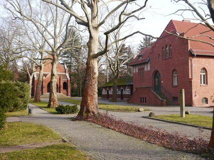
The Pankow III city cemetery is one of fifteen cemeteries in the district of Pankow and is located near the border to the city district Reinickendorf. After the construction of the Berlin Wall, the existing cemetery wall and some of the cemetery buildings were demolished in order to make way for border fortifications. The so-called “death strip” of the wall partially ran through the cemetery. Shortly after the Wall was built, an escape tunnel was dug from the west near Schönholz S-Bahn station in the direction of the cemetery, which ended in one of the graves. According to current knowledge, the “Pankow Cemetery Tunnel” was the first of about seventy escape tunnels estimated to have been dug under the Berlin Wall. One documented case is that of Waltraud N.. A few days after her wedding, she was cut off from her husband because of the newly erected border fence. In December 1961, however, she was summoned to a specific grave. She was asked to bring a bouquet of flowers and appear like a regular cemetery visitor. When she arrived at the grave, she heard a voice inviting her to jump. She then jumped into the grave and safely reached the west following the underground escape route. Approximately one hundred people are said to have successfully escaped to the west using the Pankow cemetery tunnel. Entire groups of people disguised as mourners suddenly disappeared underground. Nevertheless, border guards eventually discovered the secret tunnel and thereupon lied in wait for the next group who attempted to use it. They caught two young women who were subsequently sentenced to long prison terms.
www.chronik-der-mauer.de/fluchten
www.spiegel.de/spiegel/print/d-45139504.html
Adress:
- Am Bürgerpark 24, 13156 Berlin
S-Bahn:
- Schönholz (S1, S25, S26)
Tip:
Sowjetisches Ehrenmal Schönholzer Heide (Soviet memorial)
This military cemetery in Berlin is a large-scale memorial, with several Soviet war gravesites. More than 13,000 soldiers of the Red Army who died during the conquest of Berlin in
1945 were buried here.
Opening hours:
- April – September: 7 am - 7 pm
- October – March: 8 am - 4 pm
Adresse:
- Germanenstraße, 13156 Berlin
S-Bahn:
- Schönholz (S1, S25, S26)
S-Bahnhof Wilhelmsruh / Heidekrautbahn (heather rail)
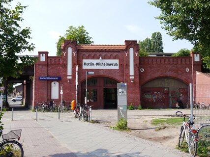
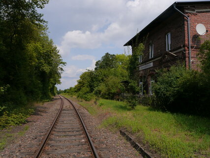
Only a few meters further on the way to the next stop on the route, you will come across a remnant of the Berlin Wall. Inconspicuously located behind a fence near the parking lot of a supermarket, it is probably the oldest remaining segment of the wall still preserved. It was only rediscovered in 2018 and looks like part of an old shed. On top of the structure you can still recognise the y-shaped, barbed wire anchors. This early section of the wall was made of masonry. Subsequently, large concrete elements were used. One hundred metres further along Klemkestraße there is the spot where 19-yearold Horst Frank was shot dead on 29 April, 1962, while attempting to flee from border troops. He is one of at least 140 victims along the Berlin Wall, i.e. people who were shot, drowned or died in some other way while trying to escape. The number of casualties is disputed. Other estimates name up to 250 victims. These estimates do not, however, include the numerous cases in which older people in particular suffered cardiac arrests while trying to escape. Wilhelmsruh station was not only an S-Bahn station, but also the starting point of the so-called “Heidekrautbahn“ (heather rail). The Heidekrautbahn brought many workers to the nearby VEB Bergmann-Borsig, one of the largest East German employers. VEB is the abbreviation for “Volkseigener Betrieb” (people’s company). With the building of the Wall, the heather rail line was cut off here. To this day, the railway has not yet been returned to operation.
Adress:
- S-Bahnhof Wilhelmsruh, 13407 Berlin
S-Bahn:
- Wilhelmsruh (S1, S25, S26)
VEB Bergmann-Borsig (publicly owned company) and Pankow Industrial Park
The VEB Bergmann-Borsig manufactured power plant components, including turbines. They were primarily intended for East German power plants, but were also exported abroad. In addition, the company was very successful with the production of electric razors.The Berlin Wall ran for a distance of two kilometres across the company premises. Since there was no room for an extensive frontier zone, a dog run was used instead. Dog runs were widespread at the former German-German border. They were installed from the beginning of the 1980s onwards as a replacement and supplement for self firing installations and minefields. Dogs were used to move along a taut steel cable on 100 to 200 meters long sections and were trained to attack those attempting to flee. Nevertheless, in spring 1962, three employees of the VEB Bergmann-Borsig, aged between 18 and 20 years, dug a tunnel from a factory building in the direction of the SBahn embankment, which was only six to eight metres away. They were able to escape.Today, the site is home to one of the largest industrial and commercial areas in Berlin.
www.tunnelfluchten.de/bergman/berg.html
Adress:
- Pankow-Park, 13158 Berlin
S-Bahn:
- Wilhelmsruh (S1, S25, S26)
Rural Border in the north of Berlin
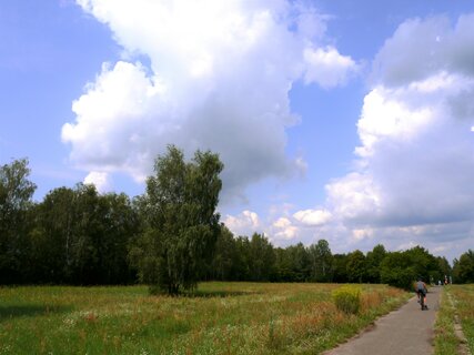
Many inhabitants of Berlin are not aware of how rural some parts of their city can appear. In the northern districts one is surrounded by nature and nature reserves. Here, the watercourse Tegeler Fliess, Köppchensee (Köppchen Lake) and the Barnim Nature Park are located. The Berlin Wall cut through these areas as well. Before a concrete wall was built, a shepherd and his flock of sheep had managed to flee to the West. There was a guarded border, but no concrete yet. By escaping, the shepherd avoided forced collectivization in the GDR (East Germany) and thus, was one of the many thousands of people who left the East German state month after month. Stopping the mass exodus was the primary function of the Wall. At first, the border merely consisted of a multi-layered barbed wire fence. Gradually the border was fortified. It was developed further and further, until, in the 1980s, the borders finally became an entirely insurmountable obstacle. The Peaceful Revolution of East German citizens, however, brought down the Wall and the partition was finally overcome.
Tip:
Botanischer Volkspark Blankenfelde-Pankow
In the midst of natural forests and meadows, the Botanische Volkspark offers a catalogue of buildings and garden art from the beginning of the 20th century. A popular learning and recreation area, the park borders on the Barnim Nature Park. and also a place for gardening. The Geological Wall is one of the attractions where you may learn much about rock types and rock strata.
www.gruen-berlin.de/botanischer-volkspark
Opening hours:
- Open daily from sunrise to sunset
- Greenhouse displays: Tuesday, Wednesday and
- Thursday from 10 am - 2 pm and during the opening
- hours of Café mint* Friday, Saturday, Sunday and on
- holidays from 11 am – 5 pm
Adresse:
- Blankenfelder Chaussee 5, 13159 Berlin
S-Bahn:
- Blankenburg (S2, S8)
Bus:
- Botanische Anlage (107)
Checkpoint Qualitz
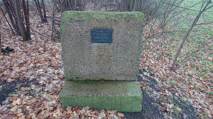
When on 9 November 1989 the Wall came down, new border crossings were built within a short period of time. Gradually, more sections of the Wall were removed and former roads as well as rail connections were restored. Nevertheless, six months after the Fall of the Wall there was still no passageway connecting the village of Lübars and the city district of Blankenfelde. This is why in June 1990, farmer Helmut Qualitz from Lübars sat down in his tractor to make a difference. First he tore down the wall segments with the help of his son and a friend. One day later, he drove his tractor to the volunteer fire department in Blankenfelde. All together they continued clearing away wall fragments until finally Blankenfelder Chaussee was passable again. After they had finished, they shared several bottles of sparkling wine and celebrated. At some point, the name “Checkpoint Qualitz” was coined as a humorous reference to “Checkpoint Charlie”, the most prominent border crossing in Berlin. In 2001 the district of Reinickendorf created a memorial stone for Helmut Qualitz. At “Checkpoint Qualitz” you have three options to continue your journey: Follow the trail straight ahead and enjoy the nature and greenery. Further remains of the former wall, however, are no longer around. You have the option to keep right and visit Blankenfelde. Here you will find a beautiful church as well as “Stadtgut Blankenfelde”, a non-profit nature, culture, life and work project. Another option is to turn left and visit the charming village of Lübars.
Adress:
- 13159 Berlin-Blankenfelde
- 13469 Berlin-Lübars
Tip:
Stadtgut Blankenfelde (city estate)
Stadtgut Blankenfelde is an ecological, generation-spanning nature, culture, living and working project. A café is also part of it. Café Traktorista: open Friday to Tuesday 12 pm – 6 pm
www.stadtgut-blankenfelde.de
Adresse:
- Hauptstraße 30, 13159 Berlin
S-Bahn:
- S-Bhf Karow (S2, RB27)
Tip:
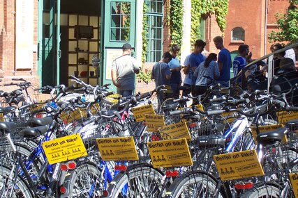
A joint action of the Berlin-Pankow Tourist Association, the Pankow District Office and Berlin on Bike.
In the next few weeks, Berlin on Bike will present these tours in a shortened 2-hour version once. As guides, the tour will be accompanied by colleagues who know the time not only from the news, but also from their own experience and can offer unique insights into the respective topic.

